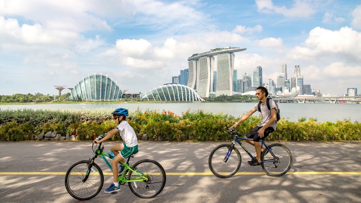
While there are myriad ways to explore our ‘city in a garden’, renting a bicycle and exploring Singapore via its Park Connector Network (PCN) is a great way to get active.
Feel the wind in your hair as you whiz through forests and sea views on your bicycle—our guide will take you through six unforgettable cycling routes across Singapore.
Southern Ridges Loop
Difficulty level: Moderate
Distance: ~9km
Cycle through green, open spaces across Mount Faber Park and Telok Blangah Hill Park on The Southern Ridges Loop. The route consists of short but steep hill terrain, so switch to your lowest gear while moving uphill.
Starting at South Buona Vista Road, cycle till you meet the 80m-long Alexandra Arch, popularly known as a ‘Gateway to Nature’. Wander along the Forest Walk, where you’d experience the dense secondary forest of Telok Blangah Hill.
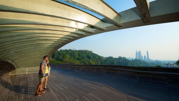
Arrive at the iconic Henderson Waves, famous for its undulating wave-like structure. Here, dismount and push your bicycles for a break, and keep an eye out for both potential photo opportunities as well as rare birds such as the Drongo and Yellow Oriole.
While making your way up to Mount Faber—one of our city’s most romantic viewpoints— slow down to watch passing ocean liners and cruise ships sail by Harbourfront.
At Mount Faber, treat yourself to hill-top dining at Arbora or Dusk. To end the perfect day, enjoy a cable car ride back to Harbourfront, bikes and satisfied appetites in tow.
Where to rent your bike: Bring your own, or rent from City Scoot Singapore.
Nearest MRT Station: Harbourfront, Exit D at Marang Road (trail takes you to the cable car station at Mount Faber).
Eastern Coastal Loop
Difficulty level: Moderate
Distance: ~20km to Changi, ~27km to Marina Bay
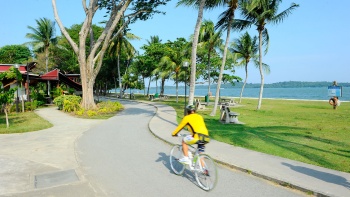
Connecting East Coast Park to Pasir Ris Park, the Eastern Coastal Loop will enthrall you with the enchanting sights of rainforest, wetland and coastal landscapes.
Start out at East Coast Park with a relaxed picnic by the sea. This is a great spot to people-watch and soak in the tropical weather to the sound of passing bicycles and the chatter of families taking a seaside stroll.
If you’d like to fuel up before your ride, indulge in a hearty meal of satay (grilled meat skewers), sambal stingray (grilled stingray served with spicy chilli paste) and barbequed chicken wings at East Coast Lagoon Food Village.
Then, hop on a bike and ride all the way to Changi Beach Park. Reward yourself with a local meal at Changi Village Hawker Centre, famous for its nasi lemak (coconut rice dish) and Goreng Pisang (banana fritters).
Alternatively, take a longer break in the cosy hideout of Little Island Brewery Co. over finger food and pizzas, before making your way back to East Coast Park.
If you prefer cycling towards urban landscapes, head in the opposite direction from East Coast Park.
You’ll find yourself cycling through Gardens by the Bay and towards Marina Barrage alongside the Marina Bay skyline. If you’re lucky, you might spot our resident otter family sunbathing along the roadside.
Where to rent your bike: From any bike rental store at East Coast Park.
Nearest MRT Station: Bedok. Take Bus 36/48/196 to Marine Parade Road, and cross from the East Coast Parkway (ECP Highway) to East Coast Park via the pedestrian underpass.
Northern Eastern Riverine Loop
Difficulty level: Easy
Distance: ~26km
An up-and-coming neighbourhood, the Punggol district is home to spacious waterways and parks that’re bound to rejuvenate your inner nature lover.
Cycling along the flat terrain of the Northern Eastern Riverine Loop will take you through the heartlands of Buangkok, Sengkang and Punggol, to Punggol Beach, and the Lorong Halus Wetland.
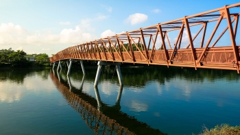
Starting at Punggol Park, cycle along and cross the Sungei Pinang footbridge to views of the scarlet-coloured Coral Plant.
Then, head to the lookout points at Punggol Promenade. Stop for a snack break at the quirky container-themed food outlets at Tebing Lane.
Ride on, and you’ll find the Lorong Halus Wetland. The size of 18 football fields, this scenic stretch was previously a landfill but is currently used to treat rainwater to sustain our city.
Be sure to take a detour to Punggol Waterway Park, fondly known as ‘Venice of Punggol’ for its winding reservoirs and suspension bridges. Sunset lovers can head to the Adventure Bridge for an unrivalled view, while early birds can head to the Sunrise Bridge to watch the day begin.
When your adventure is done, head towards Punggol Waterway Mall to wind down over a meal and some retail therapy.
Where to rent your bike: Punggol Park, at the start of Serangoon Park Connector.
Nearest MRT Station: Buangkok. Take a 10min walk to Punggol Park via the Serangoon Park Connector.
Central Urban Loop
Difficulty level: Moderate
Distance: ~36km
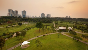
On the Central Urban Loop, Singapore’s heartlands of Bishan, Ang Mo Kio, Toa Payoh, and Whampoa will give you an intimate glimpse into the everyday life of Singaporeans.
Food lovers are in for a treat—the route passes by the Block 17 Upper Boon Keng Road and Block 79 Circuit Road Hawker Centres. Take pit stops along the way to enjoy local delights such as laksa (spicy coconut milk-based noodle soup), Fried Oyster, or an iced-cold Sugarcane drink to beat the heat.
Start from Toa Payoh Town Park, and ride through the Whampoa and Kallang Park connectors.
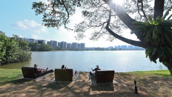
At Bishan, stop by Bishan-Ang Mo Kio Park— one of the largest urban parks in Central Singapore. With the Kallang River as its backdrop, and sprawling recreation playgrounds, you’d want to make a few more stops here to enjoy the scenery.
This route winds through heartland housing estates, so do keep to the cycling paths, and consider dismounting in the more crowded parts of the neighbourhood!
Where to rent bikes: Hin Leong Cycle, Toa Payoh.
Nearest MRT Station: Toa Payoh
Where to rent bikes: Hin Leong Cycle, Toa Payoh.
Nearest MRT Station: Toa Payoh.
Northern Explorer Loop
Difficulty level: Moderate – Challenging
Distance: ~11km
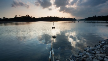
Uncover hidden gems in Singapore’s Northernmost region by cycling through the undulating terrain of Woodlands, Yishun, and Sembawang. The reward—lush forests, and seaside views from Woodlands Waterfront, one of Singapore’s longest coastal jetties.
Start from Lower Seletar Reservoir Park, a natural sanctuary that’s home to still waters and deep forests, away from the bustle of city life. As you cycle through the Mandai Park Connector, keep an eye out for cheeky, long-tailed Macaques.
At this point, brace yourself to really work those muscles, as the route gets hillier with some off-road conditions at the Ulu Sembawang Park Connector.
Arrive at Admiralty Park, and ride on to visit Woodlands Waterfront. Finish off at Sembawang Park, where one of the few natural sand beaches remain.
Where to rent bikes: No rental facility nearby—your best option is to rent from City Scoot.
Nearest MRT Station: Khatib. From there, take a 5-minute walk to the starting point at the Yishun Park Connector.
Western Adventure Loop
Difficulty level: Moderate – Challenging
Distance: ~12km
Cycling through the wild west of Singapore on the Western Adventure Loop is a great option for adventurous cyclists looking to have fun in off-the-beaten-track conditions.
Begin your journey at Choa Chu Kang Park, and cycle through the scenic Pang Sua Park Connector. Keep your eyes to the tree and the skyline as you travel along the Bukit Panjang Park Connector, which is home to over 50 different species of birds.
Pass by Zhenghua Nature Park’s rugged terrain and admire the rural charm of its untouched vegetation.
Cycle into the Dairy Farm Nature Park, which is famous amongst local outdoor enthusiasts for its rock-climbing and hiking facilities. You may want to take a quick breather here to enjoy the tranquillity far away from Singapore’s urban city centre.
Ride on to Bukit Batok Nature Park—you’ll know you’ve reached your destination when you spot the high cliff wall and a quarry pond at the entrance.
Take a short water break here, then cycle on to the last stop at Jurong Lake Gardens. The newest of Singapore’s national gardens, this verdant space is home to lush greenery and diverse fauna like otters and long tail macaques.
Where to rent your bike: No rental facility nearby. Your best option is to rent from Hin Leong Cycle and take the North-South Line down to Choa Chu Kang.
Nearest MRT Station: Choa Chu Kang. Take a 10min walk to the start point via the Choa Chu Kang Park Connector
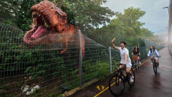
Changi Jurassic Mile Loop
Difficulty level: Easy
Distance: 6km
For those on a short transit at Changi Airport, the Changi Jurassic Mile is a good option. Despite this being the shortest route, the journey brings you ‘back in time’, offering you the chance to see more than 20 different pre-historic dinosaurs displayed over one kilometre. Along the way, you will also pass by various flora and fauna at Hub & Spoke, where you’ll find a café set in a glasshouse surrounded by luscious greenery.
This route is also the most kid-friendly. For those with little ones in tow, this will be a hit among dino-lovers and also the best way to expend their energy before the flight!
If you have more time, return to the Hub & Spoke Café and end off your journey with a nice meal. Fuel up with their all-day brunch menu, or extensive western and local fare.
Where to rent your bike: GoCycling at Hub & Spoke (access via Terminal 2). Layover passengers at Changi can book a free two-hour bicycle rental in advance on the Changi App.
Nearest MRT Station: Changi Airport. From there, proceed to Terminal 2 and follow signs to Hub & Spoke Bicycle Rental.